
![]()
![]()
![]()
![]()
2017年10月19日
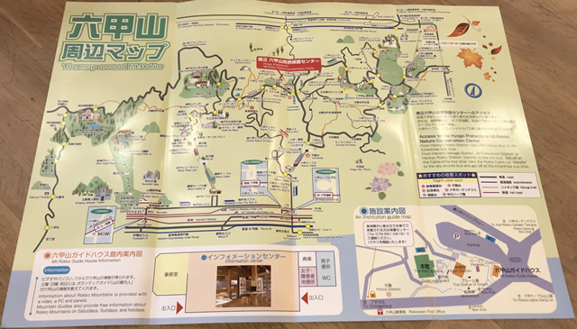
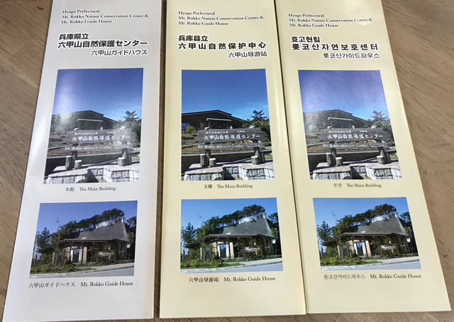
The Mt. Rokko Nature Conservation Center & Mt. Rokko Guide House is centrally located at the one traffic light on Mt. Rokko.
 Information to get to the Guide House can be found in the Access section at the bottom of the page. Once you are here, please be sure to stop by for a free map (available in several languages) and other information on what is happening on the mountain.
Roads and hiking trails from here lead in all four directions and there are many routes to choose from and places to go. Below is a list of places to travel to and the approximate walking times. Please note that depending on weather conditions these times can vary greatly.
North:
South:
East:
West:
2026年7月10日
2026年7月1日
2026年6月23日
2026年6月17日
2026年6月16日
2026年 (59)
2025年 (93)
2024年 (98)
2023年 (108)
2022年 (102)
2021年 (87)
2020年 (68)
2019年 (112)
2018年 (132)
2017年 (77)
2016年 (49)
2015年 (66)